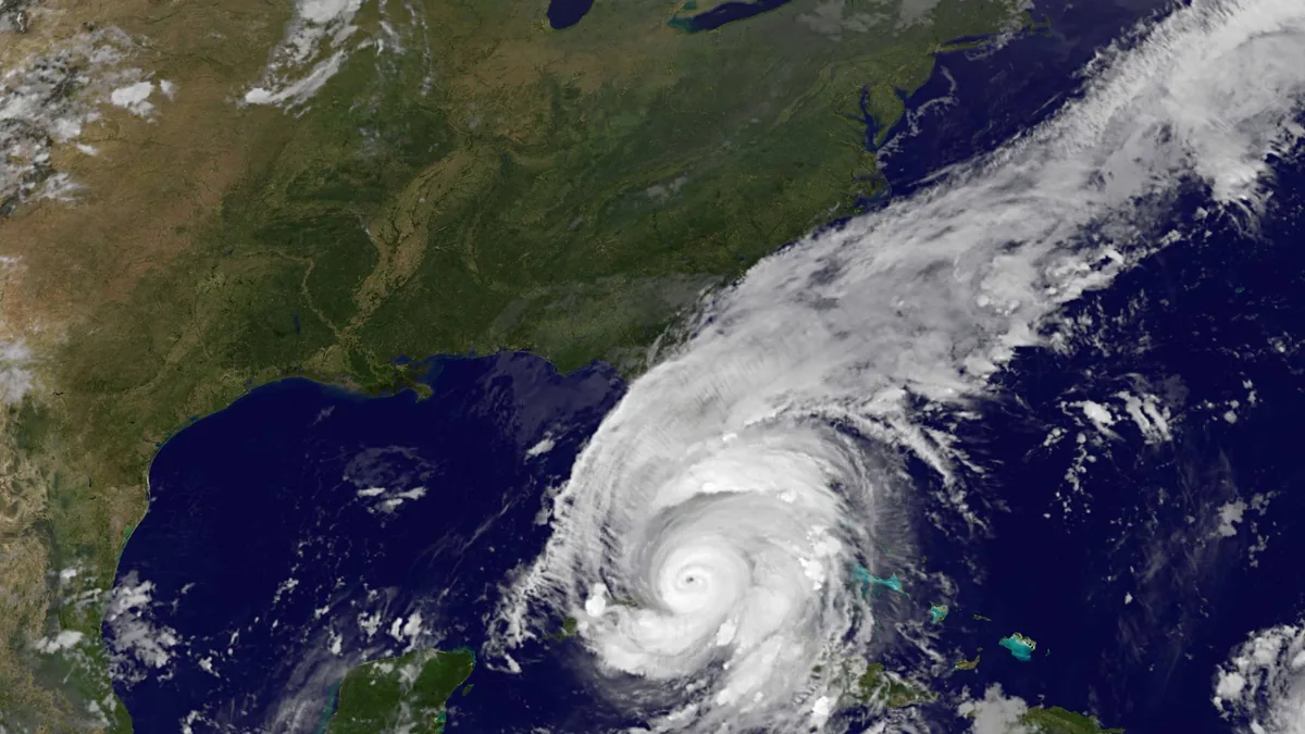
Hurricane Irma's eye made landfall at Cudjoe Key on September 10, 2017, as a Category 4 hurricane, and then at Marco Island. It did not have to pass directly over downtown Miami to put seawater into bayfront streets. The National Weather Service in Miami documented an average of 3 to 5 feet of inundation along the Biscayne Bay shoreline, from Homestead to downtown and Brickell, reaching one to two blocks inland, with isolated peaks slightly over 6 feet in Coconut Grove and Brickell.
What the official survey found
The Weather Service's Irma page is the source for the water heights used in this post. Along the oceanfront, including Miami Beach, the inundation was generally about 2 to 3 feet and was confined to the immediate beachfront. Inland of that narrow strip, the larger numbers were on the bay side.
That pattern matters if you are picturing "the beach got the worst of the water." In this storm, the official inundation along Biscayne Bay was deeper, and it reached a block or two into neighborhoods and into the downtown and Brickell waterfront. Coconut Grove and Brickell also had the isolated peaks slightly over 6 feet.
The same report notes one tornado in Miami-Dade, near Homestead-Miami Speedway. Wind and surge can happen in the same event. This post is about the water that came up from the bay.
In a tower, that usually means the lowest garage levels, lobby storage and ground-floor units, not the typical upper-floor residence. Elevator pits and building electrical rooms at grade are also in the path, which is why associations photograph those spaces and why unit owners should photograph anything they store on the lowest floor. The Weather Service figures describe water in the street and the first block or two; they do not tell you the exact depth in any one garage.
Why surge water is a cleanup and a flood claim
Water that has been in the bay, the street and the ground is not clean. IICRC S500 treats flood and surge water as Category 3. Carpet, pad, insulation and much of the lower drywall that soaked it up often have to come out. Hard surfaces can often be cleaned, but only after extraction and measured drying. The storm and flood cleanup page describes that sequence.
On the insurance side, a standard homeowners policy generally excludes flood. Surge along Biscayne Bay is rising water, which is the kind of loss a flood policy is written for. A new National Flood Insurance Program policy usually takes effect after a 30-day wait, which is why buying coverage while a storm is already named does not help that storm. If a roof or a slider also failed, that may be a separate wind claim. The flood vs. wind damage sorter and the earlier post on flood or wind walk through the split. Photograph both the exterior waterline and any broken opening before either mark is cleaned away.
What a bayfront owner can still do with this record
- Know whether the building sits in the one- to two-block bayfront strip the Weather Service described, or farther inland, and check the flood zone on the parcel rather than guessing from a street name.
- Keep a flood policy in force year-round if you have a flood risk you want covered, not only when a name is on the map.
- Store less on the lowest floor and in the lowest garage spaces as a habit, not as a last-minute chore.
- After a future surge, measure and photograph the highest waterline on walls, columns and doors, then start drying within 24 to 48 hours if it is safe to do so.
Hurricane Andrew is the county's other benchmark storm, with a much higher recorded tide at one bayfront site in 1992. The two events are not the same, and this post does not treat Irma's 3 to 5 feet as a repeat of Andrew's 16.9-foot mark. Each official number belongs to its own storm.
For buildings inside the city of Miami, including bayfront streets named in the Irma survey, the Miami area page covers local housing and flood notes.
This site is an independent referral service. If you send a request, one local provider may contact you about your home.
FAQs
How deep was Irma's surge along Biscayne Bay?
The National Weather Service reported an average of 3 to 5 feet of inundation from Homestead to downtown and Brickell, extending one to two blocks inland, with isolated peaks slightly over 6 feet in Coconut Grove and Brickell.
How high was the water on Miami Beach?
The same report describes about 2 to 3 feet along the oceanfront, including Miami Beach, confined to the immediate beachfront.
Where did Irma make landfall?
The eye came ashore at Cudjoe Key on September 10, 2017, as a Category 4 hurricane, and then at Marco Island. The Miami-Dade inundation figures are from the same official report, not from a landfall in the city itself.
Is surge covered by a homeowners policy?
A standard policy generally excludes flood, and surge is rising water. Ask your agent whether you have a flood policy in force, and notice that insurer if water rose from the bay or the street.
Sources
- National Weather Service Miami, Hurricane Irma.
- FEMA, Flood Insurance.
- IICRC, ANSI/IICRC S500.
- EPA, A Brief Guide to Mold, Moisture and Your Home.